 .....
..... ...
...
Written by John Kneski of the Kuźniewskis of Koziebrody, ©2014

........
Written by John Kneski of the Kuźniewskis of Koziebrody, ©2014
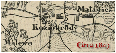
Historic Maps : 1626 ~ 1934
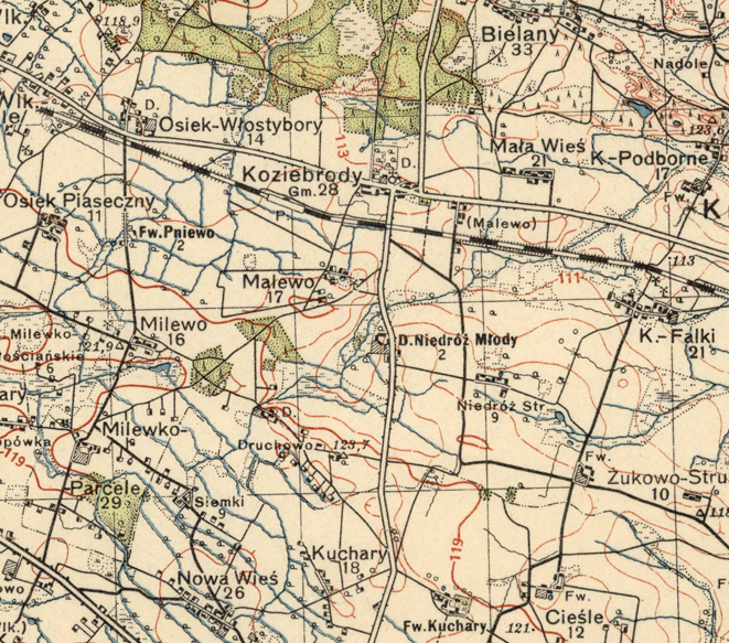
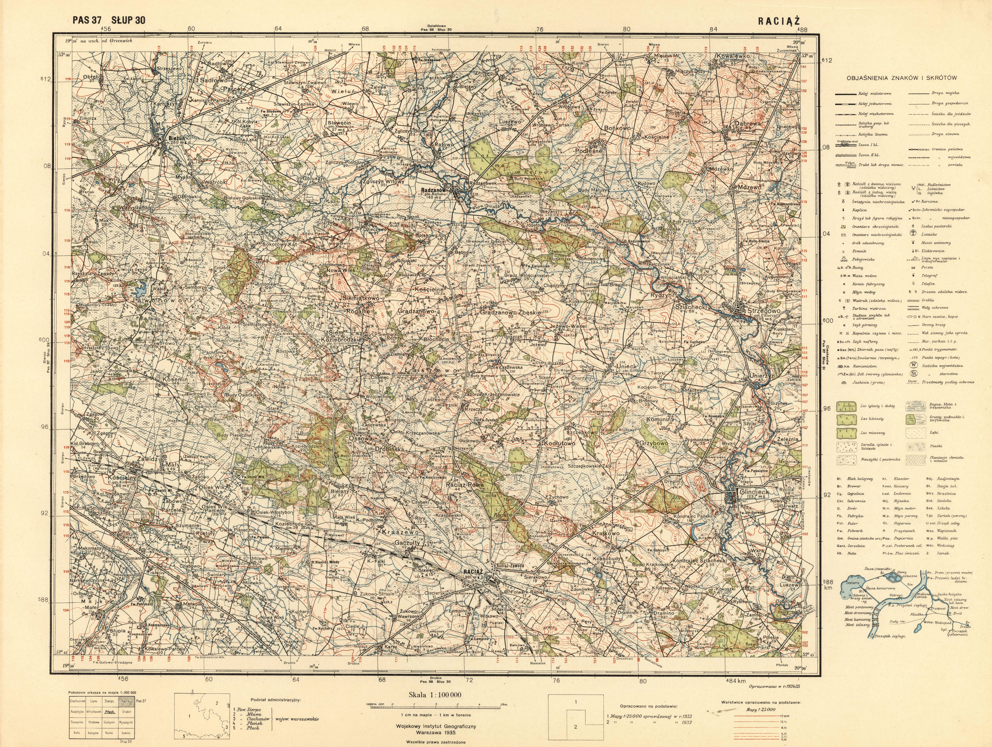
New: Detailed map of Koziebrody area from 1935
showing structures in Mala Wies.
(from the Map Archive of Wojskowy Instytut Geograficzny 1919 - 1939)
For the complete 600dpi 1935 map go here: http://www.mapywig.org/m/wig100k/P37_S30_RACIAZ.jpg
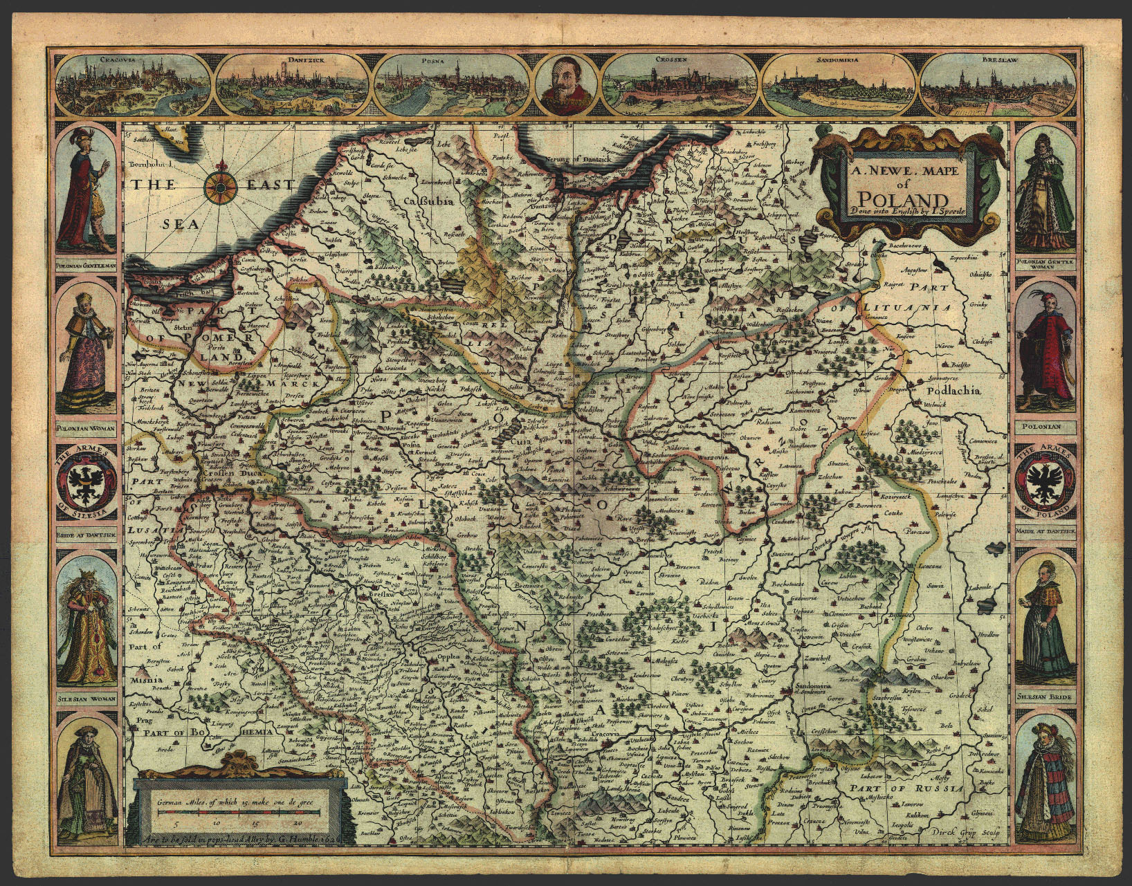
Map of Poland 1626 (large file)
Fragment: New Map of Poland, Dirck Gryp, George Humble, Gerard Mercator and John Speed, London.
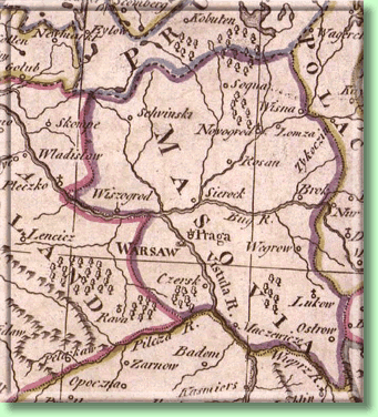
Map by Erik Johson Dahlberg ~ 1696
Ziemia Sierpecka w XVII w. Fragment z Mapy Kr—lestwa Polskiego AD 1607-1651. Autorzy: Erik Johson Dahlberg, Louis Cordier, Gerard Mercator, Samuel Puffendorf and Christoph Rigelius, Norymberga 1696.
Map of Poland 1739 (large file)
Mazowsze i wojew—dztwo plockie w XVIII w. Fragment z: Poland and Lithuenia, E.Adelbauer, Johan Doppelmajero, Jan Homann and Szymon Starowolski, Norymberga.
Map of area with Mala Wies named ~ 1770
Carte Generale et Nouvelle de toutte la Pologne, du Grand Duche de Lithuanie et des pays limitrofes. 1770, grawerowana przez B. Folino w Warszawie.
Map of area with Koziebrody named ~ 1784
Map of Sierpc Powiat with Koziebrody ~ 1904
Map of Military Movements with Koziebrody ~ 1920
Sytuacja militarna wÊpowiecie sierpeckim 13 VIII 1920 r. wÊczasie wojny polsko-bolsze-wickiej oraz kierunki dzia?ania stacjonujacego wÊSierpcu 3ÊKorpusu Konnego Gaj-Chana Bzúyszkiana. Fragment mapy pochodzacej z: J.Pi?sudski, "Pisma Zbiorowe", t.VII, 1937